Support Site Support Site

  • Support Home
    • Support Home
    • MapCast Support
  • Company Home
  • Service Sites
    • MapCast
    • MapWarehouse
    • VuMAP
  • Contact

How does the quality of satellite imagery compare with orthophoto?

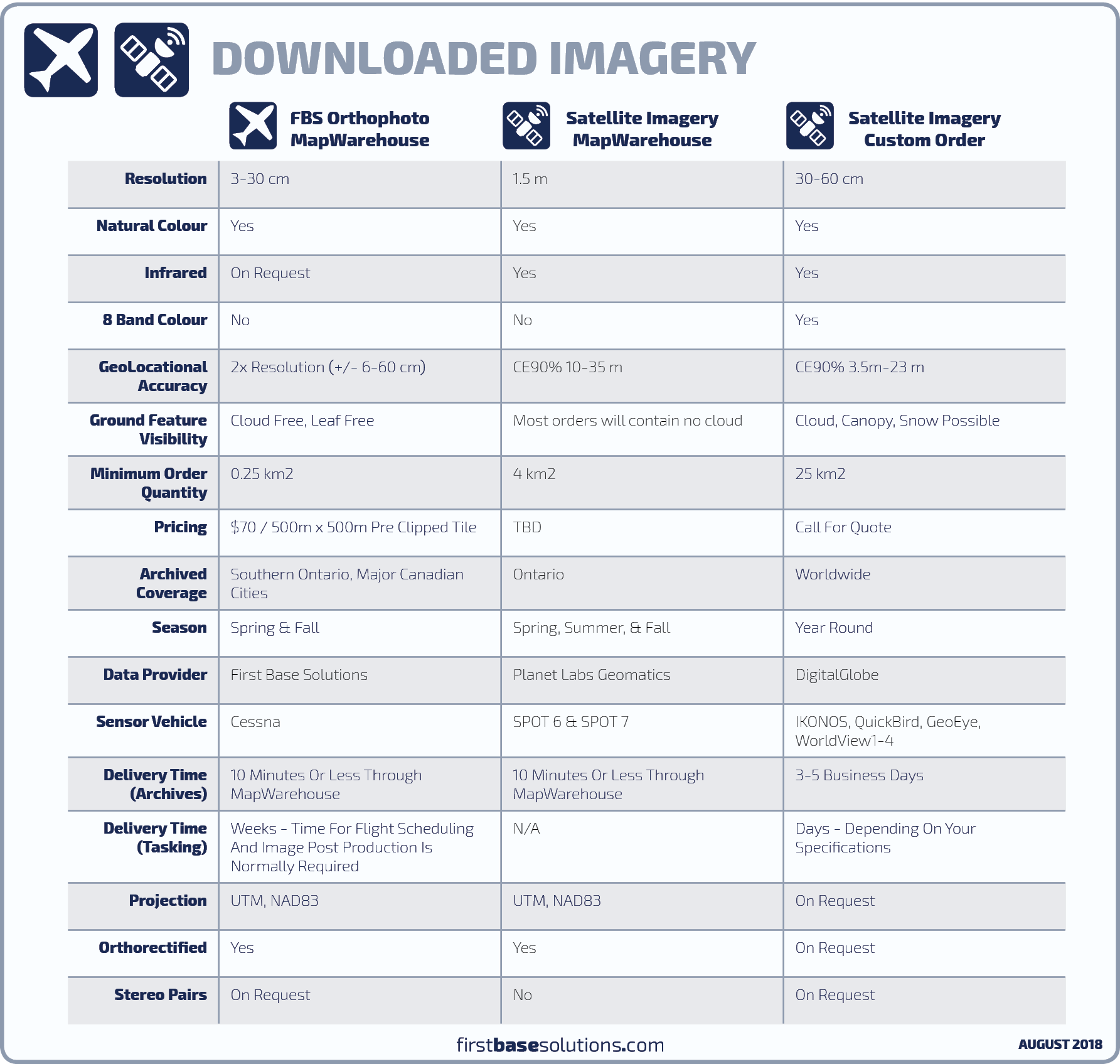
Each sensor vehicle is different. In general, the level of detail seen in the image and geolocational accuracy will be better for orthophoto flown from aircraft. Satellite imagery is superior in that new imagery can be collected and delivered on much shorter notice anywhere in the world, and includes more spectral bands outside the visible range.

Compare imagery products

DownloadableImageryCompared

First Base Solutions

140 Renfrew Dr, Suite 100
Markham, ON L3R 6B3
905-477-3600
www.firstbasesolutions.com

Keep Looking

Follow

2020 © First Base Solutions Inc.
  • Support Home
  • Corporate Home