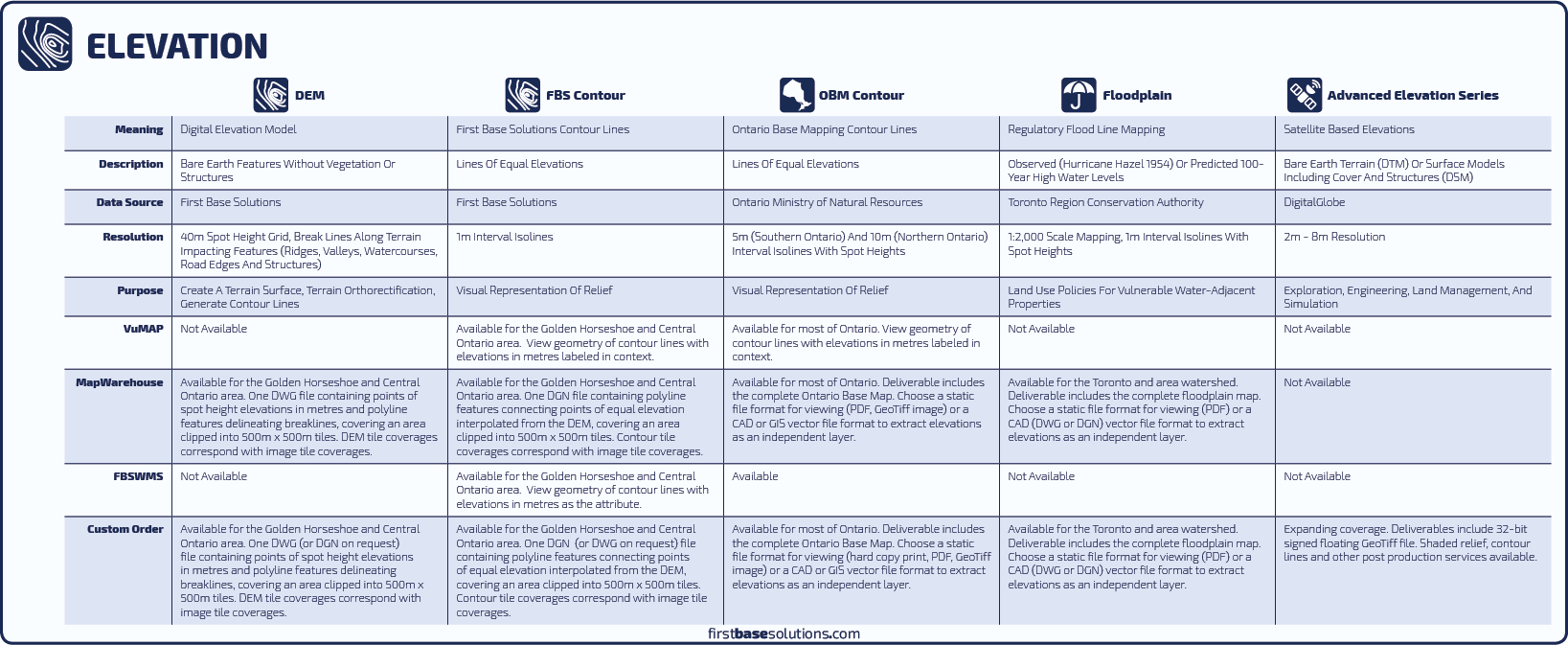
Other elevation models are simply a record of the elevations across an area. Modeling and flooding predictions made by any agency other than the Conservation Authority are of no regulatory effect. The hydraulic analysis performed by the Conservation Authority takes into account not just the volumetric limitations of a stream corridor, but also site specific characteristics such as soil types, and impervious material like rooftops and asphalt, which affect the rate at which a watershed can discharge surplus water and return to normal flow. The floodplain map alone can be considered an administrative tool.

