Support Site Support Site

  • Support Home
    • Support Home
    • MapCast Support
  • Company Home
  • Service Sites
    • MapCast
    • MapWarehouse
    • VuMAP
  • Contact
Home / 3. Post-Sales, 6. VuMap / How to determine which layer I’m looking at in VuMAP?

How to determine which layer I’m looking at in VuMAP?

1840 views Less than a minute

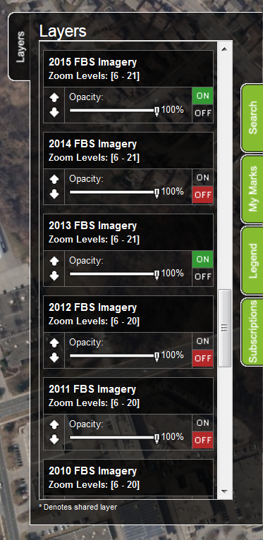
The layers will draw in the order you see them in the layers list, drawing the bottom most visible layers in the list, then drawing the visible layers above it over top. Since the imagery is opaque and completely covers an area, it will hide any layers that have drawn below it. In the image below, only the 2015 imagery can be seen even though the 2013 imagery is also visible.

It’s a good idea to keep imagery layers at the bottom and put points, lines, and areas such as roads and property lines at the top. You can adjust the order the layers draw in by using the up and down arrows below the layer’s name.

layerstroubleshootingtutorialvisibility 3. Post-Sales6. VuMap

Search Everything

FAQ’s

CAD (13) Data (54) Elevations (23) Flood Line (10) Groundwater (5) LiDAR (2) MapCast (15) MapWarehouse (38) Ontario Base Mapping (16) Orthophoto (34) Parcels (15) Post-Sales (35) Pre-Sales (49) Sales (24) Satellite (13) Troubelshooting (20) Tutorial (14) VuMAP (15)

Article Categories

  • 401. Pre-Sales
  • 252. Sales
  • 293. Post-Sales
  • 94. MapCast
  • 135. MapWarehouse
  • 106. VuMap
  • 27. News
  • 598. Data
  • 79. My Account
  • 3VuMap Help

First Base Solutions

140 Renfrew Dr, Suite 100
Markham, ON L3R 6B3
905-477-3600
www.firstbasesolutions.com

Keep Looking

Follow

2020 © First Base Solutions Inc.
  • Support Home
  • Corporate Home