VuMap provides an advanced measurement tool that is capable of determining to-scale dimensions of drawings made within the VuMap interface in various dimensions. Not only does this include the lengths of individual lines and segments, but area and perimeter as well. By using the measurement tool, the user is able to estimate distances, and other data using VuMap’s built-in automation.
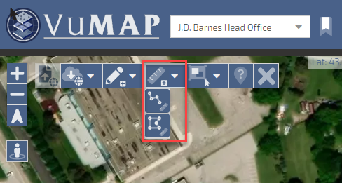
The measurement tool is located within the tool bar at the top of the map page. The user has the option to use two of the drawing tools in VuMap; the line and polygon tools.
- The line tool will be able to create line segments to measure distances and total lengths.
- The polygon tool on the other hand is able to create enclosed shapes when the user double-clicks the final vertex.

Measure tool location
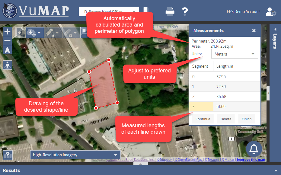
When using the measurement tool, a tab will appear on the map interface providing the user with real-time data regarding their drawing. This assists the user to quantitatively make lines and shapes within the map interface. VuMap calculates and displays the area and perimeter of this enclosed shape.

Measure tool features
