Support Site Support Site

  • Support Home
    • Support Home
    • MapCast Support
  • Company Home
  • Service Sites
    • MapCast
    • MapWarehouse
    • VuMAP
  • Contact
Home / 1. Pre-Sales, 8. Data / Do PIN and ARN parcels have the same boundaries?

Do PIN and ARN parcels have the same boundaries?

3326 views Less than a minute

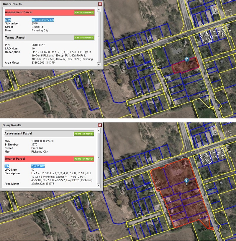
PIN stands for “Property Identification Number” which is linked to ownership, ARN stands for “Assessment Roll Number” and is used for property value assessment purposes. More information can be found on the Ontario Parcel web site at: www.ontarioparcel.ca. The boundaries are often the same, but not always. For this reason, PIN and ARN are maintained in separate data bases. The images below from VuMAP show both PIN and ARN results produced from a single query location (PIN in yellow, ARN in blue).

ARNfile formatsmetadataparcelPIN 1. Pre-Sales8. Data

Search Everything

FAQ’s

CAD (13) Data (54) Elevations (23) Flood Line (10) Groundwater (5) LiDAR (2) MapCast (15) MapWarehouse (38) Ontario Base Mapping (16) Orthophoto (34) Parcels (15) Post-Sales (35) Pre-Sales (49) Sales (24) Satellite (13) Troubelshooting (20) Tutorial (14) VuMAP (15)

Article Categories

  • 401. Pre-Sales
  • 252. Sales
  • 293. Post-Sales
  • 94. MapCast
  • 135. MapWarehouse
  • 106. VuMap
  • 27. News
  • 598. Data
  • 79. My Account
  • 3VuMap Help

First Base Solutions

140 Renfrew Dr, Suite 100
Markham, ON L3R 6B3
905-477-3600
www.firstbasesolutions.com

Keep Looking

Follow

2020 © First Base Solutions Inc.
  • Support Home
  • Corporate Home